Blizzard Like Conditions One Day After Record Warmth in Central New York
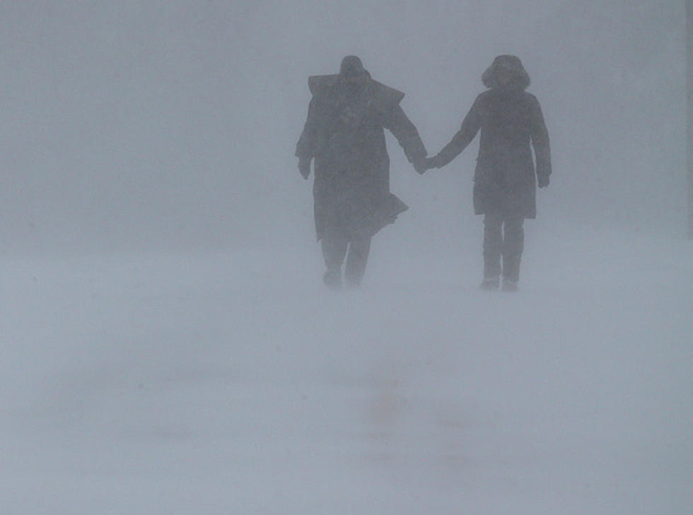
Blizzard-like conditions with up to a foot of snow are possible in Central New York, one day after record-warm temperatures.
Parts of Central New York were in the low 70s, beating a 24-year record for February 27. But things are about to drastically change. Lake Effect snow could dump anywhere from 3 to 11 inches and high winds could create near whiteouts across the area.
Lake Effect Snow Warning
The National Weather Service has issued a Lake Effect Snow Warning from 10 PM Wednesday, February 28 until 7 PM February 29 for Onondaga, Madison, and Southern Oneida counties.
READ MORE: Norovirus Outbreak in CNY
Heavy lake effect snow is expected with 3 to 6 inches, 7 to 11 inches in the heaviest band. 30 MPH winds gusting could lead to near-blizzard conditions at times.
Travel could be very difficult. Areas of blowing snow could significantly reduce visibility. The hazardous conditions could impact the morning or evening commute, including in the Syracuse area.
High Wind Warning
A High Wind Warning is in effect from 2 PM February 28 to 7 AM February 29 for Northern Oneida, Yates, Seneca, Southern Cayuga, Onondaga, Madison, and Southern Oneida counties.
READ MORE: Major Retailer Closing 150 Stores
Wind gusts up to 60 MPH could blow down trees and power lines. Widespread power outages are expected.
People should avoid being outside in forested areas and around trees and branches. If possible, remain in the lower levels of your home during the windstorm, and avoid windows. Use caution if you must drive.
Long Range CNY Forecast
Wednesday: Showers likely, then showers and possibly a thunderstorm after 4 PM. High near 66. Windy, increasing to 25 to 30 mph in the afternoon. Winds could gust as high as 48 mph.
Wednesday Night: Rain and snow showers, becoming all snow after 9 PM. Areas of blowing snow after 1 AM. Low around 18. Windy, with gusts as high as 55 mph.
Thursday: Snow showers likely, mainly before 3 PM. Areas of blowing snow between noon and 1 PM. Mostly cloudy, with a high near 24. Blustery, with gusts as high as 36 mph.
Thursday Night: A chance of snow showers, mainly before 11 PM. Mostly cloudy, with a low of around 19.
Friday: Sunny, with a high near 50.
Friday Night: Mostly cloudy, with a low of around 35.
Saturday: Partly sunny, with a high near 53.
Saturday Night: Mostly cloudy, with a low of around 39.
Sunday: Partly sunny, with a high near 60.
Sunday Night: Partly cloudy, with a low around 43.
Monday: Partly sunny, with a high near 61.
Monday Night: Mostly cloudy, with a low of around 46.
Tuesday: A chance of showers. Partly sunny, with a high near 59.
20 Sure Signs Spring is Near in CNY
21 Adventures You Need to Add to Your Summer Bucket List
Gallery Credit: Credit - Polly McAdams
More From Big Frog 104