A Scuba Diving Guide To Brilliant Shipwrecks In The St Lawrence River
Have you ever wanted to scuba dive shipwrecks in the St. Lawrence River? Here's a few to check out in the Thousand Islands of the New York and Canadian border.
Scuba Diving To These Brilliant Shipwrecks In The St Lawrence River- Thousand Islands
These Utica and Rome Restaurants From Your Childhood Need To Make A Delicious Come Back
Check It Out: 6 Splash Pads in Central New York to Enjoy This Summer
10 Utica and Rome Area Pizza Places That Deserve Way More Attention
Here's that list again:
Scuba divers allegedly call the 1000 Islands the “Caribbean of the North” due to all the amazing places to check out. The Saint Lawrence River has been the main shipping route between the Great Lakes and the Atlantic Ocean for centuries. That means you're able to see that history in the ships that line the bottom. According to South Eastern Ontario, divers can generally see 50 to 60 feet in front them most of the year, and 60 to 100 feet in the fall time.
From wooden schooners to War of 1812 battleships to modern-day freighters, over 200 vessels met their fate here."
There are all sorts of local businesses and more that can help train you, or charter you, on these dives if you're interested. You can read more here.
Here's a list of some of the coolest dives to check out:
The Islander Shipwreck
The Islander is located at Latitude: 44° 20' 17.4984" N, Longitude: -75° 55' 11.9316" W. According to ShipWreckWorld, the wreck is right off of the parking area just east of the hospital in Alex Bay.
The Islander lies on the slope between 20 to 60 feet in depth."
The boat sank back in 1909. You can watch a dive to the ship on YouTube here.
The Catherine Shipwreck
The Caterine Shipwreck dive seems to be for far more experienced divers. It is located at Latitude: 44° 20' 55.4388" N, Longitude: -75° 54' 46.6812" W. The Catherine sank bank in 1890. You can watch a dive to the ship on YouTube here.
The Sir Robert Peel Shipwreck
The Sir Robert Peel shipwreck is located at Latitude: 44° 18' 2.4012" N, Longitude: -75° 59' 10.5612" W. The ship sank back in 1838 due to pirates:
One evening in 1838 she was tied up at Wellesley Island for firewood, however she experienced a visit by “pirate” Bill Johnston and friends disguised as Indians. After looting everything they set fire to the “Peel” and set her adrift to sink."
According to Sharky Scuba, The “Peel” is located just upstream from the 1000 Islands Bridge. She sits in 120-135 ft. of water with her boiler sitting in about 80 ft. of water. This dive is an advanced dive.
The Keystorm Shipwreck
The Keystorm Shipwreck is located at Latitude: 44° 25' 46.0812" N, Longitude: -75° 49' 21.7812" W. According to ShipWreckWorld, it is located one mile west of Oak Island, located in the middle of St Lawrence River:
The Keystorm was a cargo steamer. She measures 250 feet in length with a 42.5 foot beam. On October 26, 1912 on night with much fog, she ran into the Scow Island Shoal. the Keystorm slde off of the shoal and finally sank in deeper water."
The dive is considered advanced, you can watch a video on YouTube here.
The America Shipwreck
The America Shipwreck is located at Latitude: 44° 27' 1.08" N, Longitude: -75° 48' 35.3988" W. Divers say it's approximately 600ft off the southwest corner or Singer Castle Island between Brockville and Malloytown. You can watch a dive of the ship on YouTube here.
The Oconto Shipwreck
The Oconto Shipwreck is located at Latitude: 44° 17' 0.4812" N, Longitude: -76° 0' 57.1788" W. According to Wrecks and Reefs, this is not an easy dive:
The hazards include the current in the channel that varies from mild to ripping your mask off; the absence of lines leading to the wreck and the weird positioning of the wreck (in three parts, stern upside down, bow upright)."
You can check out some amazing photos here, and watch a dive on YouTube.
The A E Vickery Shipwreck
The A E Vickery shipwreck is located at Latitude: 44° 16' 48.8388" N, Longitude: -76° 1' 8.2812" W. It's right near the Rock Island Lighthouse.
A.E. Vickery was a wooden three-masted schooner built in 1861 and measured 136.2 ft. x 26.2 ft. x 10.8 ft. A. E. Vickery sank on 17 August 1889 when she struck a shoal while entering the American Narrows with a cargo of 21,000 bushels of corn."
The wreck now rests at a depth of about 115 ft. You can watch a dive on YouTube here.
The Henry C Daryaw Shipwreck
The Henry C Daryaw shipwreck is located at Latitude: 44° 31' 34.0212" N, Longitude: -75° 45' 45.2412" W. According to Save Ontario Shipwrecks, you can spot it by a line tied off to the wreck at the bottom of the Rudder.
The hull lies upside down with damage caused when she struck visible. Both props and the rudder are still present as well as the anchors."
The ship is about 80ft under. You can watch a dive on YouTube here.
The Kinghorn Shipwreck
The Kinghorn shipwreck is located at Latitude: 44° 22' 36.3612" N, Longitude: -75° 55' 50.2788" W. According to ShipWreckWorld, it's directly in front of the customs office and a marina at Rockport, Ontario.
The Kinghorn was in a tow with 6 other schooners by the tug, Hiram A. Walker in April of 1897. The tow was headed to Montreal when a storm sank three of the schooner barges."
You can watch a video of dive to the shipwreck on YouTube here.
The Eastcliffe Hall Shipwreck
The Eastcliffe Hall shipwreck is located at Latitude: 44° 55' 28.8012" N, Longitude: -75° 6' 4.2012" W. According to Visit STLC, the wreck is approximately ¾ mile south of Crysler Marina, at Upper Canada Village, Morrisburg, Ont.
This steel freighter weighing 3,335 tons and 343 feet long struck a shoal at 4 a.m. on July 14, 1970 while carrying a load of "pig iron". It sank within minutes and nine lives were lost. There were 12 survivors."
You can watch a video of the dive on YouTube.
The Maggie Shipwreck
The Maggie Shipwreck is located at Latitude: 44° 14' 42.6012" N, Longitude: -76° 5' 48.5988" W. According to ShipWreckWorld, the wreck is located between Governors Island and the docks at Clayton on the southside of the shipping channel.
The 90 feet wooden schooner Maggie L was one of the last commercial sailing ships on Lake Ontario and the St Lawrence River. In November of 1927 the bow of the Maggie L was severed by a steel freighter as she was leaving the shipping channel for Clayton"
You can watch a video of the dive on YouTube here.
The Roy A Jodrey Shipwreck
The Roy A Jodrey shipwreck is located at Latitude: 44° 19' 51.3588" N, Longitude: -75° 56' 3.1812" W. According to ShipWreckWorld, its located right near Pullman Shoal St. Lawrence River off of the Coast Guard Station. You can watch a video of the dive here. This ship is 254ft down underwater.
The Fred Mercur Shipwreck
The Fred Mercur shipwreck is located at Latitude: 45° 2' 3.0012" N, Longitude: -74° 37' 18.9012" W. You will find the wreck 25ft underwater on the west side of Stanley Island near Cornwall in Canada. You can watch a video of a dive to the ship on YouTube here.
The St Louis Shipwreck
The St Louis shipwreck is located at Latitude: 44° 8' 0.6" N, Longitude: -76° 19' 14.4012" W. According to ShipWreckWorld, the wreck is off of the down river side of the Cape Vincent village boat ramp:
The schooner barge St Louis was built in 1864 and sank in 1914."
You can watch a video of a dive to the ship on YouTube here.
The Dauntless Shipwreck
The Dauntless shipwreck is located at Latitude: 44° 14' 56.4" N Longitude: -76° 4' 18.5988" W.
The Dauntless lies in 50 feet of water mid way between Round Island and Washington Island just east of Clayton."
You can watch a dive to the ship on YouTube here.
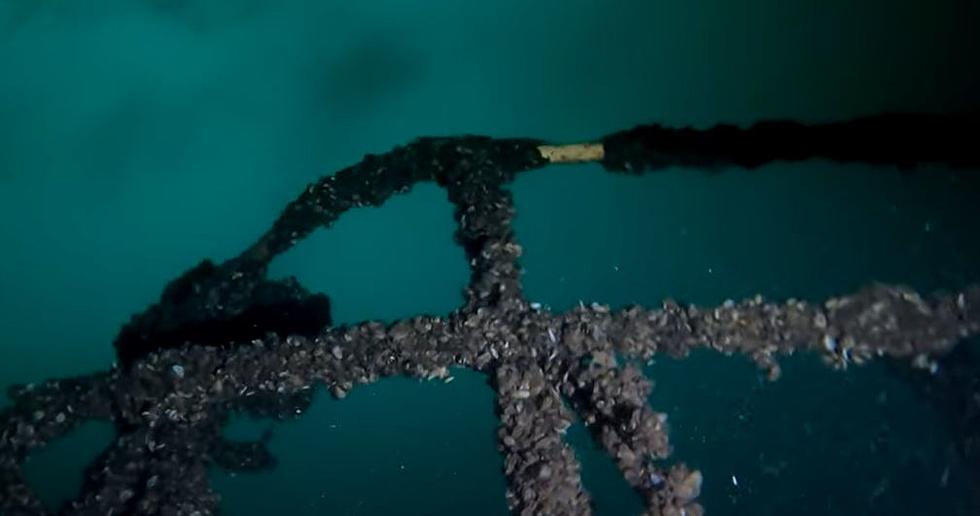
The Grindstone Island Cars Shipwreck
The Grindstone Island Cars shipwreck is located at Latitude: 44° 16' 14.0318" N, Longitude: -76° 5' 22.2976" W. This wreck has various cars scattered on the river bed. You can watch the dive to this location on YouTube.
The Rothesay Shipwreck
The Rothesay shipwreck is located west of Prescott. It is accessible both by land and by boat. According to SaveOntarioShipwrecks.ca, the wreck is accessible both by land and by boat:
Follow Highway 401 and take the Highway 18 Exit (#716) to Prescott. Turn west on King St. W (Highway 2) and follow for 1.75 Km until you reach Riverview Heights. There you will see a Historic Marker along the south side of the road commemorating Justus Sherwood. The adjoining grass strip can accommodate about a dozen cars."
You can watch a video of the dive on YouTube here.
Where To Find The Best Wood Fired Pizza In The Utica And Rome Area
More From Big Frog 104