April Fools’ Winter Storm Is No Joke – We Could See 10 Inches Of Snow In Utica/Rome/Syracuse
Don't put the shovel away. This April Fools' storm is NOT funny. The National Weather Service has issued a Winter Storm Watch for most of Central New York. We could see up to 10 inches of snow.

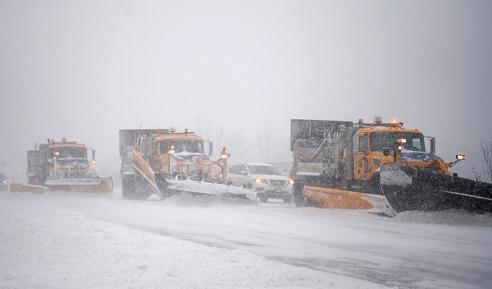
A developing storm along the coast will have the potential to produce significant accumulating wet snow Wednesday night into Thursday, especially across North Central New York.

The snow will be wet and heavy, which could lead to scattered power outages and will be very difficult to shovel and may cause power outages.
...WINTER STORM WATCH IN EFFECT FROM WEDNESDAY EVENING THROUGH
THURSDAY EVENING...
Northern Oneida-Yates-Seneca-Southern Cayuga-Onondaga-Steuben-Schuyler-Tompkins-Madison-Southern Oneida-Cortland-Including the cities of Boonville, Penn Yan, Seneca Falls, Auburn, Syracuse, Corning, Hornell, Watkins Glen, Ithaca,
Hamilton, Oneida, Rome, Utica, and Cortland
* WHAT...Heavy snow possible. Total snow accumulations of 5 to 10 inches possible.
* WHERE...Northern Oneida, Yates, Seneca, Southern Cayuga, Onondaga, Steuben, Schuyler, Tompkins, Madison, Southern Oneida and Cortland counties.
* WHEN...From Wednesday night through Thursday evening.
* IMPACTS...Travel could be very difficult. The hazardous conditions could impact the morning and evening commutes on Thursday. Also, snow will likely be wet and heavy and may lead to power outages.

A cold front will move through tomorrow (3/30), bringing widespread rain showers that will change to lake effect snow during the evening and continue through Thursday and early Friday, with significant accumulations possible in Central NY.
Wednesday night, we could see moderate to heavy snowfall overnight...for much of the Finger Lakes region into the NY Thruway corridor with isolated amounts of 6 inches where the heaviest snow band sets up...The exact snow amounts are still quite uncertain, with this storm initially starting as very wet snow....Lake effect snow showers will continue into Thursday night...with an additional inch or 2 possible wherever the heaviest lake effect bands set up.

Extended NWS Forecast:
Tonight: Mostly clear, with a low around 45. Southeast wind around 9 mph.
Wednesday: Showers, mainly afternoon. High near 57. Southeast wind 6 to 9 mph. Chance of precipitation is 90%—new precipitation amounts between a tenth and quarter of an inch possible.
Wednesday Night: Rain before 1AM, then rain and snow. Low around 31. Northwest wind 6 to 8 mph. Chance of precipitation is 90%—new snow accumulation of around 2 inches.
Thursday: Snow before 10AM, then rain and snow between 10AM and 3PM, then snow likely after 3PM. High near 37. Northwest wind 8 to 14 mph. Chance of precipitation is 80%.
Thursday Night: Snow likely before 8PM, then a chance of snow showers after 8PM. Mostly cloudy, with a low around 21. Chance of precipitation is 60%.
Friday: A chance of snow showers. Partly sunny, with a high near 35. Chance of precipitation is 40%.
Keep Up-To-Date
Take us everywhere you go with our new App. Listen live with all of your favorite shows with fewer commercials. The new app lets you call, message or tweet at us anytime or send us photos and videos. The app also gives you the ability to receive notifications about breaking news, weather alerts, traffic advisories and school closings happening in and around Central New York.
Winter Weather Preparation:
- Keep your cell phone charged and make sure you know where your backup power supply is.
- Make sure all your flashlights have fresh batteries.
- Fill your gas tank. You can use your car to keep warm and recharge devices.
- Have some food available that you don’t need to cook.
**FOR POWER OUTAGES:
Get up to information on power outages throughout Central New York; where it’s out and when it’ll be restored with National Grid’s Power Outage Map.
National Grid also offers text alerts on the latest efforts to restore power.
To receive free text message alerts and updates, text the word STORM to NGRID (64743). E-mail alerts are available to customers who create an online profile on the company’s website. All alert services can be started and stopped at the customer’s request.
You can even report power outages or get the latest information at National Grid’s website.
TIPS: Here's how you can prepare for power outages
More From Big Frog 104